Questions 1-8
1. Greece and China used the ocean as a resource for food and even warfare. The Vikings and Polynesians used the ocean to explore and they found some areas for example Hawai'i.
2. Recording and writing down points of navigation is do prove that the work or anything found there was found. To be able to find the area again and for creditation.
3. New areas, new species of plants and animals, marine science, etc.
4. Captain James Cook was supposed to be searching for Venus, second voyage was to find Antarctica, and the third voyage was to find Hawai'i.
5. USEE, 6 ships with 300 men, first ship was to carry scientists, sign treaties, explore places, search for one more coninent, collect marine specimines, measure currents, and test water. They found many species of plants and fish and named most of them. Because of all these findings, this began marine biology for the United States.
6. They went on a voyage strictly to study oceanography. They explored for 4 years to study the currents, temperature, and the bottom of the ocean.They documented their whole journey.
7. It started in Italy and a man from the U.S. went there. He came back to California and desperately wanted to build and instiution for marine biology. In 1903 Scripps was built, this was inspired by the institutes in Italy.
8. 3 quarters of the planet is used for oceanography, in order to study the ocean you would have to be willing and able to spend a large amount of time on a ship and be able to collect and test your data.
Cartography

The science or practice of drawing maps
Celestial Navigation

The action of finding one's way by observing the sun, moon, and stars
Chart

A sheet of information in the form of a table, graph, or diagram
Chronometer

An instrument for accurately measuring time
Compass

An instrument containing a magnetized pointer that shows the direction of magnetic north and bearings from it
Dark Ages

The period in western Europe between the fall of the Roman Empire
Echo Sounder

A device for determining the depth of the seabed or detecting objects in water by measuring the time taken for echoes to return to the surface
Glomar Challenger

The 120m long Glomar Challenger was a deep sea research and scientific drilling vessel for oceanography and marine geology studies
GPS

Global Positioning System: a global system of U.S. navigational satellites developed to provide precise positional and velocity data and global time synchronization for air, sea, and land travel
Latitude & Logitude

A coordinate system that uses numbers and letters to locate places on Earth.
Oceanographic Institution

A place dediated to stdying and learning about species, plants, water of the ocean
Renaissance

The revival of art and literature under the influence of classical models in the 14th–16th centuries
Satellite Oceanography

Obtain measurements of the surface temperature, color, surface height and currents, as well as the wind stress that drives the ocean circulation
Sounding
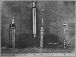
The action or process of measuring the depth of the sea or other body of water
